Knapp & Langer Lakes, July 17-21
The Knapp Lakes section of this hike rates right up at the top of the list of most difficult endeavours to date! It is not only
predominantly in a burn area, which is the most difficult type of hiking imaginable, but it further underscores the futility
of attempting to use a Topo map as the final word in geography or trail/road locations. These bloody maps are classic
government. A great sounding idea on the surface, but in the final analysis, completely worthless. They were surveyed in the
30's or 40's and, for the most part, never updated. So they show roads that don't exist, trails that have returned to nature, and
simply cannot be used to determine anything except where the mountains might be.
Further, this area is unique in my experience, in that it has water seeping out of every nook and cranny in this drainage. Without
a carefully laid out trail to follow (it has been allowed to revert to nature), you are at the mercy of a bazillion swamps created
by this seepage. Sometimes it is just wet, but the next step may just be into gooshy mud over the top of the boots. After 2 or 3
miles of this stuff, you can get frustrated to the point of calling curses down on the entirety of govt. land managers (for letting
the
trail
revert, not because there's water there).
Finally, our stay at Knapp Lakes was shortened considerably due to the fact that our visit unfortunately coinsided with a large
group of horses & young males that consumed the entirety of the one camping area at this location. Not only did we have to camp
in unquestionably substandard accomodations, but after a day of the normal hoo-rahing of the young boys as they were fishing,
swimming, and generally causing havoc, we had to make the decision to seek quieter domains elsewhere.
That took us to Langer/Ruffneck Lakes area and a well-defined and cleared trail... sort of. Another burn area, and another
trail with a great deal of winter deadfall over the trail. It had been cleared, but only up to Langer Lake. Huh? This is a small
area, with several lakes, and even on Google Maps it is clear that the trail goes, at the minimum, to Ruffneck Lake. After
Langer Lake it is only 1/2 mile to Ruffneck. Why in the bloody world would you not clear all the way?? So, to get to Ruffneck,
it is over, and around, the myriad of fallen trees. That expands the difficulty of hiking to the nth degree.
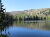 Knapp Lakes Knapp Lakes |
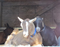 Camping RON |
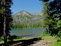 Langer/Ruffneck Lakes |
|---|